
Mount Rainier, Washington · USA
Wonderland Trail
Eleven days all the way around Mount Rainier, through old-growth forest, glacier rivers and wildflower meadows, camping each night under the mountain.
- 11 days
- 139 km
- 6,900 m of climbing
- 10 nights in camps
Photo NPS Photo, Public domain
The Wonderland Trail circles Mount Rainier in about 150 km, and it is never flat: you climb out of deep forested valleys onto high meadows and drop back down again, more than 6,500 m of ascent in all. The trail was completed in 1915, and it still feels like a pilgrimage around a single great mountain.
You sleep in designated wilderness camps, each with a bear pole and a toilet, and you need a permit for every night. Most hikers walk clockwise from Longmire and send food caches ahead to the ranger stations, so that the pack is never heavier than a few days' food.
At a glance
Fly the route
Wonderland Trail from above
139 km on the real trail, over 3D terrain, past every chapter of the story.
Meditation planWith St Francis of Assisi: prayers for every day of the trek
Walked under the patronage of St Francis of Assisi. The saint who praised God for Brother Sun, Sister Water and every creature. A walk around a whole mountain, through forest, meadow, snow and glacier river, is a walk through his Canticle. Feast day: 4 October.
Every day
Setting out
Each morning, before you lace your boots or at the trailhead.
Pray the morning praise of the creatures
Praised be you, my Lord, for Brother Sun, who brings the day and lights the snow on the mountain before he reaches our camp.
I offer you today's miles around this mountain: the long climbs out of the river valleys, the roots and the switchbacks, the heavy pack. Let me walk gently on your earth, and see your hand in every tree and every creature. Amen.
V.St Francis,
R.pray for us.
At noon
Wherever you are on the trail, stop, take off your pack and pray together.
Pray the noon praise of the trail
Praised be you, my Lord, for Sister Water, grey with glacier silt and loud in the canyon, who carries the mountain down to the sea.
Praised be you for the old forest and its giant trees, for the marmot whistling on the rocks and the flowers in the meadows. Make us their brothers and sisters, and keep us grateful all afternoon. Amen.
The words echo the Canticle of the Creatures, written by St Francis in 1225.
Pray the Angelus
V.The Angel of the Lord declared unto Mary,
R.And she conceived of the Holy Spirit.
Hail Mary, full of grace, the Lord is with thee; blessed art thou among women, and blessed is the fruit of thy womb, Jesus. Holy Mary, Mother of God, pray for us sinners, now and at the hour of our death. Amen.
V.Behold the handmaid of the Lord.
R.Be it done unto me according to thy word.
Hail Mary…
V.And the Word was made flesh,
R.And dwelt among us.
Hail Mary…
V.Pray for us, O holy Mother of God,
R.That we may be made worthy of the promises of Christ.
Let us pray.
Pour forth, we beseech thee, O Lord, thy grace into our hearts; that we, to whom the incarnation of Christ thy Son was made known by the message of an angel, may by his passion and cross be brought to the glory of his resurrection. Through the same Christ our Lord. Amen.
In camp
Each evening before you sleep: look back over the day, give thanks, ask for tomorrow.
Pray the Examen under the trees
Sit outside your tent as the light goes. God is here, in the trees and the stars.
Give thanks for three creatures you met today, great or small.
Ask for light to see the day as God sees it.
Walk back over the day. Where did you notice beauty? Where did you only notice the miles?
Did you treat anyone, or anything, carelessly today? Ask forgiveness.
Ask for what tomorrow needs: legs for the climb, eyes for the beauty.
Praised be you, my Lord, for Sister Moon and the stars, clear and precious and beautiful. St Francis, pray for us. Amen.

Days 1–2
Into the old forest
Longmire → South Puyallup River Camp
- 18.4 km
- ↑ 1,244 m
- ↓ 817 m
- 8 h walking, about 4 h a day
Nights: Devil's Dream Camp · South Puyallup River Camp
From Longmire the trail climbs through old-growth forest of fir and cedar to the meadows of Indian Henry's Hunting Ground, with its patrol cabin and a side path to the Mirror Lakes, where Rainier fills the water.
On the second day you cross the Tahoma Creek suspension bridge, swaying high above a glacial torrent, and climb onto Emerald Ridge beside the broken ice of the Tahoma Glacier before dropping to camp by the South Puyallup River.
Don't miss
- The Mirror Lakes side trip at Indian Henry's.
- The suspension bridge over Tahoma Creek.
Meditation for days 1–2
“I have lifted up my eyes to the mountains, from whence help shall come to me.”
Psalm 120:1 (121:1)
The bridge sways, but it holds. Trust is a step taken before you feel sure.

Days 3–4
Lakes of the west side
South Puyallup River Camp → Mowich Lake Camp
- 33.0 km
- ↑ 1,697 m
- ↓ 1,520 m
- 13 h walking, about 6 h 30 a day
Nights: Golden Lakes Camp · Mowich Lake Camp
The west side is the quietest part of the loop. Climb to St Andrews Lake and the flower meadows of Klapatche Park, where little Aurora Lake holds the whole mountain, then traverse Sunset Park to the Golden Lakes and their old patrol cabin.
Next day you drop a long way to the South Mowich River, cross its braided channels, and climb steeply to Mowich Lake, the largest and deepest lake in the park. Many hikers pick up their first food cache here.
Don't miss
- Rainier reflected in Aurora Lake at Klapatche Park.
- A swim, briefly, in Mowich Lake.
Meditation for days 3–4
“Be still and see that I am God.”
Psalm 45:11 (46:10)
Still water shows the mountain. Find ten minutes of stillness today.

Days 5–6
The Carbon Glacier
Mowich Lake Camp → Mystic Camp
- 20.1 km
- ↑ 1,183 m
- ↓ 966 m
- 8 h 30 walking, about 4 h 30 a day
Nights: Carbon River Camp · Mystic Camp
The main route crosses Ipsut Pass and descends through deep forest to the Carbon River; the Spray Park alternative climbs instead through some of the finest flower meadows in the Cascades. Either way, you cross the Carbon River on a suspension bridge.
Then the trail climbs beside the Carbon Glacier, a river of grey, rock-covered ice whose snout reaches lower than any other glacier in the contiguous United States. You hear it creak and rumble before you reach Mystic Lake.
Don't miss
- The sound of the Carbon Glacier moving.
- Evening at Mystic Lake below the north face of Rainier.
Meditation for days 5–6
“He took Peter, and James, and John, and went up into a mountain to pray.”
Luke 9:28
The glacier moves too slowly to see, yet it carves valleys. So does faithfulness.

Days 7–8
Sunrise and Summerland
Mystic Camp → Summerland Camp
- 29.2 km
- ↑ 1,405 m
- ↓ 1,328 m
- 11 h walking, about 5 h 30 a day
Nights: Granite Creek Camp · Summerland Camp
A short day over open ground to Granite Creek, then the longest of the loop: over Skyscraper Pass to Sunrise, the highest point in the park you can reach by road, with its visitor centre and a food cache, and down past Shadow Lake to the White River.
The afternoon climb up Fryingpan Creek ends in the meadows of Summerland, beneath the jagged peak of Little Tahoma. Mountain goats often graze above camp.
Don't miss
- The view from Skyscraper Pass.
- Mountain goats on the slopes above Summerland.
Meditation for days 7–8
“Come apart into a desert place, and rest a little.”
Mark 6:31
Halfway round the mountain. Thank God for the legs, the friends and the weather that brought you here.

Day 9
Panhandle Gap
Summerland Camp → Indian Bar Camp
- 6.4 km
- ↑ 326 m
- ↓ 524 m
- 3 h walking
- sleep at 1,560 m
A short day with the highest point of the trail. Above Summerland the meadows give way to rock, snow and small tarns, and the path climbs to Panhandle Gap at about 2,070 m. Snow often lies here into August.
Beyond the gap the trail traverses high above the Ohanapecosh valley before dropping to Indian Bar, where a stone shelter looks across at Wauhaukaupauken Falls.
Don't miss
- The view south from Panhandle Gap to Mount Adams.
- Evening light on the falls at Indian Bar.
Meditation for day 9
“For in his hand are all the ends of the earth: and the heights of the mountains are his.”
Psalm 94:4 (95:4)
The highest point of the loop is a gap, not a summit. Sometimes the way through is lower than the way over.
Panhandle Gap can hold steep snow well into summer; carry microspikes early in the season and check with the rangers.

Days 10–11
Home through the forest
Indian Bar Camp → Longmire
- 31.8 km
- ↑ 1,003 m
- ↓ 1,702 m
- 11 h 30 walking, about 5 h 30 a day
Nights: Maple Creek Camp · then on to Longmire
Down the long Cowlitz Divide into forest again, past the narrow slot of Box Canyon, to camp by Maple Creek. The last day follows Stevens Canyon past Martha Falls and climbs to Reflection Lakes, where Rainier stands upside down in the water.
From there it is down past Narada Falls and the Paradise River, through quiet forest, to Longmire, where you started eleven days and one whole mountain ago.
Don't miss
- Rainier mirrored in Reflection Lakes.
- Narada Falls on the way down.
Meditation for days 10–11
“May the Lord keep thy coming in and thy going out; from henceforth now and for ever.”
Psalm 120:8 (121:8)
You have walked all the way around something too big to climb. Some mysteries are honoured by circling them with love.
Before you go
No churches or chapels are mapped within 1.5 km of this trail in OpenStreetMap. Plan your Sundays in the day-by-day planner.
Permits
Every night needs a wilderness permit for a named camp. Reservations open by lottery in early spring; some permits are kept for walk-ups.
When
Mid-July to late September. Earlier, snow covers the high passes; in autumn the days are short and storms arrive.
Food caches
Hikers send food caches ahead to the ranger stations at Longmire, Mowich Lake and Sunrise or White River. Check the park's current rules.
Rivers and bears
Glacial rivers rise on warm afternoons. Hang all food on the bear poles at every camp.
The numbers
139 km, about 6,900 m of climbing, high point 2,080 m. Walking times use the Alpine signpost rule, without breaks.
The practical side
- Where you sleep
- Designated wilderness camps only, booked on your permit; no huts.
- Permits & bookings
- Wilderness permit for every night. Reservations go through an early-access lottery in spring on Recreation.gov; leftover sites are released as walk-up permits.
- Water
- Streams and lakes at most camps; glacial silt clogs filters, so let it settle or pre-filter.
- Food & resupply
- Food caches can be left at Longmire, Mowich Lake, Sunrise and White River.
- Direction
- Either way round; clockwise from Longmire is a common choice.
- Getting there & away
- Drive to Longmire, Mowich Lake or Sunrise; there is no public transport to the trailheads.
- Stages
- 10–14 days between designated camps, often with 1,000 m of climbing a day in and out of valleys.
Rules, fees and booking systems change. Check the official source before you go: Mount Rainier National Park (wilderness permits) ↗
Books for the trail

Of this place
Holy the Firm
Annie Dillard · 1977 · Spirituality
Written on an island in Puget Sound, within sight of the Cascade volcanoes, this short book wrestles with God, suffering and holiness. Dillard later became a Catholic.
Find it on Open Library →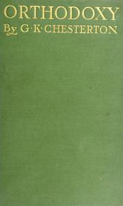
Nonfiction
Orthodoxy
G. K. Chesterton · 1908 · Spirituality
Chesterton's lively account of how he came, step by step, to Christian faith, and his argument that wonder is the right response to the world. On a trail named for wonder, the obvious choice. He became a Catholic in 1922.
Find it on Open Library →
Fiction
A Good Man Is Hard to Find
Flannery O'Connor · 1955 · Short story
O'Connor's stories of grace breaking, often violently, into ordinary lives in the American South. One story a night in camp, and enough to think about on the next day's climb.
Find it on Open Library →Circling a mountain for two weeks, you learn it has many faces, and so do the people you love.
Other treks nearby
Written by Alto from maps, park information and trip reports. Check current conditions, closures and permit rules with Mount Rainier National Park. Route © OpenStreetMap contributors (ODbL).