
Vancouver Island, British Columbia · Canada
West Coast Trail
Six days along the wild edge of Vancouver Island, on a path cut to rescue shipwrecked sailors: lighthouses and sea lions, a waterfall on the beach, ladders and cable cars, and the long rollers of the Pacific beside you.
- 6 days
- 76 km
- 1,400 m of climbing
- 5 nights in beach camps
Photo Paxson Woelber, CC BY 2.0
The West Coast Trail follows 75 km of coast between Bamfield and Port Renfrew, a shore so dangerous to ships that it was called the Graveyard of the Pacific. After the steamer Valencia was wrecked here in 1906, with the loss of more than a hundred lives, a lifesaving trail was cut along the coast so that shipwrecked sailors could be found and brought to safety.
Today it lies in Pacific Rim National Park Reserve, in the territories of the Huu-ay-aht, Ditidaht and Pacheedaht First Nations. It is a hard walk: mud, roots and boardwalk in the rainforest, slippery rock shelves on the beaches, dozens of ladders, and cable cars to haul yourself over the rivers. This route goes north to south from Pachena Bay, so the easier kilometres come while your pack is heaviest.
At a glance
Fly the route
West Coast Trail from above
76 km on the real trail, over 3D terrain, past every chapter of the story.
Meditation planWith Our Lady, Star of the Sea: prayers for every day of the trek
Walked under the patronage of Our Lady, Star of the Sea. For centuries sailors and fishermen have called on Mary as Stella Maris, the Star of the Sea, to guide them home. On a coast known as the Graveyard of the Pacific, the walk is under her care.
Every day
Setting out
Each morning, before you lace your boots or at the trailhead.
Pray the offering for the lifesaving trail
Lord, this path was cut so that shipwrecked sailors could be found and brought home. Let me walk it today as a path of mercy.
I offer you the mud and the ladders, the tide and the rain, the weight on my back and the friends beside me. Keep us safe on the rocks and the cable cars, and make me ready to help anyone in need. Amen.
V.Mary, Star of the Sea,
R.pray for us.
At noon
Wherever you are on the trail, stop, take off your pack and pray together.
Pray the noon prayer for those at sea
Father, at noon we look out over the Pacific and remember all who have been lost on this coast, the passengers and crew of the Valencia, and the fishermen and sailors since. Give them rest.
Protect everyone at sea today, in storm and in calm. Bless the lightkeepers and the rescuers, and the First Nations whose coast this is. Amen.
V.Mother of Christ, Star of the Sea,
R.pray for the wanderer, pray for me.
The last lines are from the 19th-century hymn "Hail, Queen of Heaven, the Ocean Star".
Pray the Angelus
V.The Angel of the Lord declared unto Mary,
R.And she conceived of the Holy Spirit.
Hail Mary, full of grace, the Lord is with thee; blessed art thou among women, and blessed is the fruit of thy womb, Jesus. Holy Mary, Mother of God, pray for us sinners, now and at the hour of our death. Amen.
V.Behold the handmaid of the Lord.
R.Be it done unto me according to thy word.
Hail Mary…
V.And the Word was made flesh,
R.And dwelt among us.
Hail Mary…
V.Pray for us, O holy Mother of God,
R.That we may be made worthy of the promises of Christ.
Let us pray.
Pour forth, we beseech thee, O Lord, thy grace into our hearts; that we, to whom the incarnation of Christ thy Son was made known by the message of an angel, may by his passion and cross be brought to the glory of his resurrection. Through the same Christ our Lord. Amen.
In camp
Each evening before you sleep: look back over the day, give thanks, ask for tomorrow.
Pray the Examen by the surf
Sit by the fire as the waves roll in, and be still. God is here.
Give thanks for the beach, the rainforest, the sea lions and the people who walked with you.
Ask for light to see the day as God sees it.
Walk back over the day. When did you feel safe? When did you need help?
Was there a moment when you hurried past someone who needed you? Ask forgiveness.
Look at tomorrow's tides, and ask for patience and courage.
And he turned the storm into a breeze: and its waves were still… and he brought them to the haven which they wished for. (Psalm 106:29–30)
Mary, Star of the Sea, pray for us. Glory be to the Father, and to the Son, and to the Holy Spirit; as it was in the beginning, is now, and ever shall be, world without end. Amen.

Day 1
The lighthouse
Pachena Bay → Michigan Creek
- 12.1 km
- ↑ 229 m
- ↓ 180 m
- 3 h 30 walking
- sleep at 5 m
After the compulsory orientation at Pachena Bay, the trail sets off gently through tall rainforest along the old lifesaving route. Pachena Point Lighthouse stands at the edge of the cliffs at about km 10.
Drop to the beach at Michigan Creek for the first night. Watch for sea lions on the rocks offshore, and for gray whales passing along the coast.
Don't miss
- Pachena Point Lighthouse on its cliff.
- Sea lions on the rocks offshore.
Meditation for day 1
“I have lifted up my eyes to the mountains, from whence help shall come to me.”
Psalm 120:1 (121:1)
This path was made to bring the lost home. Pray today for anyone who is lost.
Orientation at the trailhead is compulsory. It covers the tides, bears, cougars and the ferries.

Day 2
Tsusiat Falls
Michigan Creek → Tsusiat Falls
- 12.4 km
- ↑ 177 m
- ↓ 194 m
- 3 h 30 walking
- sleep at 5 m
Walk the beach and the forest in turn, past the Valencia Bluffs, where the ship went down, and over the Klanawa River by cable car: sit in the cart and pull yourself across on the cable.
At the end of the day Tsusiat Falls pours straight off a low cliff onto the beach, and you camp on the sand beside it, with fresh water falling from the sky.
Don't miss
- The cable car over the Klanawa River.
- Tsusiat Falls pouring onto the beach.
Meditation for day 2
“Come to me, all you that labour, and are burdened, and I will refresh you.”
Matthew 11:28
A waterfall gives itself away without stopping. Ask for a generous heart.

Day 3
Nitinat Narrows
Tsusiat Falls → Cribs Creek
- 17.8 km
- ↑ 348 m
- ↓ 358 m
- 5 h 30 walking
- sleep at 5 m
Pass through Hole in the Wall, a sea arch at Tsusiat Point that you can walk through at low tide, then cross Nitinat Narrows on the Ditidaht ferry, a short boat ride over the mouth of a tidal lake.
Beyond the narrows the trail runs along beaches and rock shelves full of tide pools to Cribs Creek, where a natural breakwater of rock shelters the beach camp.
Don't miss
- Walking through Hole in the Wall at low tide.
- The ferry across Nitinat Narrows.
Meditation for day 3
“Jesus himself also drawing near, went with them.”
Luke 24:15
The tide decides when you may pass. Learn to wait on God's time.
Several beach sections, including Hole in the Wall, can only be passed at low tide. Carry the tide table from your orientation and plan each day around it.

Day 4
Carmanah
Cribs Creek → Walbran Creek
- 11.6 km
- ↑ 250 m
- ↓ 230 m
- 3 h 30 walking
- sleep at 5 m
Walk past Carmanah Point Lighthouse, one of the lighthouses on this coast still kept by lightkeepers, and along long sandy beaches past Bonilla Point.
Camp at the mouth of Walbran Creek, a wide, clear river crossed by cable car, and swim in the pools upstream if the sun is out.
Don't miss
- Carmanah Point Lighthouse.
- A swim in Walbran Creek.
Meditation for day 4
“Thy word is a lamp to my feet, and a light to my paths.”
Psalm 118:105 (119:105)
The keepers tend a light for ships they may never see. Do one hidden kindness today.

Day 5
Ladders and cable cars
Walbran Creek → Camper Bay
- 9.3 km
- ↑ 127 m
- ↓ 114 m
- 2 h 30 walking
- sleep at 5 m
The southern part is the hardest of the trail. The beach gives way to rainforest, and the trail climbs in and out of steep gullies on ladders, some of them dozens of rungs high, with cable cars over Cullite Creek and Camper Creek.
Cross the long suspension bridge at Logan Creek, then come down the ladders to Camper Bay for the last night on the beach.
Don't miss
- The suspension bridge over Logan Creek.
- Evening on the beach at Camper Bay.
Meditation for day 5
“Be still and see that I am God.”
Psalm 45:11 (46:10)
Up the ladder, down the ladder, one rung at a time. Faith is often just the next rung.

Day 6
To Port Renfrew
Camper Bay → Gordon River
- 12.8 km
- ↑ 286 m
- ↓ 356 m
- 4 h walking
- finish at 10 m
The last day stays mostly in the forest: mud, roots, fallen logs and more ladders. At low tide you can take the beach route around Owen Point instead, past surge channels and sea caves, but only with the tide table in hand.
The trail ends at the Gordon River, where the Pacheedaht ferry carries you across to Port Renfrew, muddy, tired and glad.
Don't miss
- The surge channels at Owen Point, at low tide.
- The ferry across the Gordon River at the end.
Meditation for day 6
“May the Lord keep thy coming in and thy going out; from henceforth now and for ever.”
Psalm 120:8 (121:8)
You arrive at the end muddy and grateful. Give thanks for the people who made the way, and for the people who walked it with you.
Before you go
No churches or chapels are mapped within 1.5 km of this trail in OpenStreetMap. Plan your Sundays in the day-by-day planner.
Permits
An overnight use permit and reservation from Parks Canada for the season from 1 May to 30 September. Bookings open in winter and fill fast, and orientation at the trailhead is compulsory.
Tides
Some beach routes are passable only at low tide. Plan each day with the tide table, and use the forest route when in doubt.
Wildlife
Black bears, wolves and cougars live on this coast. Use the food caches at the campsites and keep your group together.
Getting there
Seasonal shuttle buses run to the trailheads at Bamfield (Pachena Bay) and Port Renfrew from Victoria and Nanaimo. Short ferries cross Nitinat Narrows and the Gordon River.
The numbers
76 km, about 1,400 m of climbing, high point 20 m. Walking times use the Alpine signpost rule, without breaks.
The practical side
- Where you sleep
- Beach and creek campsites; first come, first served once you're on the trail.
- Permits & bookings
- Overnight use permit and reservation from Parks Canada (open 1 May to 30 September). Bookings open in winter and fill fast. Mandatory orientation at the trailhead.
- Water
- Creeks and rivers; treat everything, as some are tannin-stained.
- Food & resupply
- None along the trail; carry all your food.
- Direction
- Either way. Starting at Pachena Bay puts the easier northern section first, while your pack is heaviest.
- Getting there & away
- Trailheads at Bamfield (Pachena Bay) and Port Renfrew (Gordon River), linked to Victoria and Nanaimo by seasonal shuttle buses. Short ferries cross Nitinat Narrows and the Gordon River.
- Stages
- 5–7 days. Some beach sections are passable only at low tide, so carry the tide table from your orientation.
Rules, fees and booking systems change. Check the official source before you go: Pacific Rim National Park Reserve ↗
Books for the trail

Of this place
Mission to Nootka, 1874–1900
A. J. Brabant · 1977 · History
The reminiscences of a Belgian priest who spent a quarter of a century at Hesquiat on the wild west coast of Vancouver Island, among the Nuu-chah-nulth peoples and the shipwrecks of this coast.
Find it on Open Library →
Nonfiction
Something Beautiful for God
Malcolm Muggeridge · 1971 · Biography
The journalist's portrait of Mother Teresa and her sisters in Calcutta, caring for the dying no one else would touch; he later became a Catholic himself. The West Coast Trail began as a lifesaving route, cut after the wreck of the Valencia in 1906 to rescue shipwrecked sailors.
Find it on Open Library →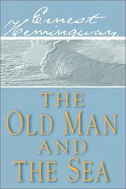
Fiction
The Old Man and the Sea
Ernest Hemingway · 1952 · Novel
An old Cuban fisherman, who says his Our Fathers and Hail Marys, fights a great marlin far out at sea. Hemingway's short masterpiece, for a trail along the Pacific edge, with fishing boats at either end.
Find it on Open Library →This trail was cut to rescue shipwrecked sailors. Every path can become someone's way home.
Other treks nearby
Written by Alto from maps, park information and trip reports. Check current conditions, closures and reservation rules with Pacific Rim National Park Reserve. Route © OpenStreetMap contributors (ODbL).