
Pennine Alps · France · Switzerland
Walker's Haute Route
Two weeks from Mont Blanc to the Matterhorn: eleven high passes, from Chamonix over the Fenêtre d'Arpette and the Col de Prafleuri, past the Lac des Dix and the lakes of Moiry and down the Europaweg into Zermatt.
- 14 days
- 209 km
- 13,500 m of climbing
- 13 nights in huts and villages
Photo Andrew Bossi, CC BY-SA 2.5
The Walker's Haute Route crosses the Pennine Alps from Chamonix in France to Zermatt in Switzerland, from the foot of Mont Blanc to the foot of the Matterhorn, cutting across the grain of the mountains. Each day climbs out of one deep valley over a high pass and drops into the next: Trient, Bagnes, Hérens, Anniviers, Turtmann, and at last the Mattertal.
Halfway, around Zinal, French gives way to German. The villages change too, from stone and slate to dark larch-wood chalets on stone feet, but in every one there is a church, and the bells ring the hours across the valley. The route crosses eleven passes, most of them above 2,800 m, and some hold snow into July.
At a glance
Fly the route
The Walker's Haute Route from above
209 km on the real trail, over 3D terrain, past every chapter of the story.
Meditation planWith St Theodulus of Sion: prayers for every day of the trek
Walked under the patronage of St Theodulus of Sion. The first known bishop of the Valais, in the fourth century, and its patron saint. The Theodul Pass above Zermatt, the old crossing into Italy beside the Matterhorn, carries his name. Feast day: 16 August.
Every day
Setting out
Each morning, before you lace your boots or at the trailhead.
Pray the offering for the passes
Lord, today there is a pass to cross: a long climb, a narrow gap in the rock, and a new valley on the other side. I offer you the whole of it, the effort and the view, and the people I love at home.
As St Theodulus carried the Gospel into these valleys, let me carry your peace from one village to the next. Keep my feet steady on the scree and the snow, and bring us safely down. Amen.
V.St Theodulus,
R.pray for us.
At noon
Wherever you are on the trail, stop, take off your pack and pray together.
Pray the noon prayer on the col
Every valley shall be exalted, and every mountain and hill shall be made low. (Isaiah 40:4)
Father, from this col we see the road behind us and the road ahead. Thank you for the climb that is done. Give us strength for the long way down, and bless the villages below, their churches and their families, and everyone who keeps the huts. Amen.
Pray the Angelus
V.The Angel of the Lord declared unto Mary,
R.And she conceived of the Holy Spirit.
Hail Mary, full of grace, the Lord is with thee; blessed art thou among women, and blessed is the fruit of thy womb, Jesus. Holy Mary, Mother of God, pray for us sinners, now and at the hour of our death. Amen.
V.Behold the handmaid of the Lord.
R.Be it done unto me according to thy word.
Hail Mary…
V.And the Word was made flesh,
R.And dwelt among us.
Hail Mary…
V.Pray for us, O holy Mother of God,
R.That we may be made worthy of the promises of Christ.
Let us pray.
Pour forth, we beseech thee, O Lord, thy grace into our hearts; that we, to whom the incarnation of Christ thy Son was made known by the message of an angel, may by his passion and cross be brought to the glory of his resurrection. Through the same Christ our Lord. Amen.
In camp
Each evening before you sleep: look back over the day, give thanks, ask for tomorrow.
Pray the Examen in the valley
When the bells ring in the village below, be still. God is here.
Give thanks for the pass you crossed and the valley that welcomed you.
Ask for light to see the day as God sees it.
Walk back over the day, from the first climb to the last descent. Where did you feel God near? Where did you forget him?
Was there a moment of impatience on the hard ground, or pride at the top? Ask forgiveness.
Look at tomorrow's pass, and ask for the grace you will need.
St Theodulus, pray for us.
Glory be to the Father, and to the Son, and to the Holy Spirit; as it was in the beginning, is now, and ever shall be, world without end. Amen.

Days 1–2
Chamonix to Trient
Chamonix → Trient
- 23.7 km
- ↑ 1,343 m
- ↓ 1,074 m
- 10 h walking, about 5 h a day
Nights: Argentière · Trient
The first day is a gentle walk up the Chamonix valley on the balcony paths above the river, with the glaciers of Mont Blanc hanging over you, to the village of Argentière.
The second climbs over the Col de Balme, at 2,191 m, on the border between France and Switzerland, with a last great view back down the length of the Chamonix valley to Mont Blanc. Then down to Trient, a small village beneath its glacier with a pink church.
Don't miss
- Mont Blanc from the Col de Balme.
- The pink church of Trient.
Meditation for days 1–2
“I have lifted up my eyes to the mountains, from whence help shall come to me.”
Psalm 120:1 (121:1)
Look back once at where you started, then turn towards the road ahead.
On the way: Église Saint-Michel, Chapelle des Tines, Saint-Pierre.

Day 3
The Fenêtre d'Arpette
Trient → Champex
- 14.0 km
- ↑ 1,238 m
- ↓ 1,036 m
- 8 h walking
- sleep at 1,466 m
From Trient, climb beside the Trient Glacier, its icefall tumbling down from the plateau above, then up a steep rocky slope to the Fenêtre d'Arpette, a narrow notch at 2,665 m.
The way down the other side is a long slope of boulders into the Val d'Arpette, gentle meadows and larches at the bottom, to Champex and its small lake.
Don't miss
- The icefall of the Trient Glacier.
- An evening walk round the lake at Champex.
Meditation for day 3
“Jesus himself also drawing near, went with them.”
Luke 24:15
A window in the rock, and a whole new valley beyond. Ask God to open a window in your heart.
On the way: église St-Bernard et environs.
The Fenêtre d'Arpette is rough and can hold snow early in the season. In bad weather take the lower route over the Bovine alp to Champex.

Days 4–5
Down to the Val de Bagnes and up to Mont Fort
Champex → Cabane du Mont Fort
- 28.4 km
- ↑ 1,821 m
- ↓ 890 m
- 12 h 30 walking, about 6 h a day
Nights: Le Châble · Cabane du Mont Fort
An easy day down through the woods and farming villages to Sembrancher, then up the Val de Bagnes to Le Châble, the lowest point of the whole route.
The next day climbs more than 1,600 m, through the hamlets above Le Châble and the high meadows by Clambin, to Cabane du Mont Fort, high above Verbier. The views from the hut terrace stretch west back to Mont Blanc and the Grand Combin.
Don't miss
- The villages of the Val de Bagnes.
- Sunset from the terrace of Cabane du Mont Fort.
Meditation for days 4–5
“Thy word is a lamp to my feet, and a light to my paths.”
Psalm 118:105 (119:105)
The lowest valley comes before the highest climb. Gather strength in the low places.
On the way: Eglise catholique, Église Saint-Étienne, Eglise du Châble.

Days 6–7
Prafleuri and the Lac des Dix
Cabane du Mont Fort → Arolla
- 32.2 km
- ↑ 1,761 m
- ↓ 2,129 m
- 14 h walking, about 7 h a day
Nights: Cabane de Prafleuri · Arolla
From Mont Fort, a balcony path traverses under the peaks, then the route crosses the Col de Louvie and the Col de Prafleuri, a bare world of rock and old snow, and drops to Cabane de Prafleuri in a barren basin.
The next morning, over the Col des Roux, the Lac des Dix appears: a long reservoir held back by the Grande Dixence, one of the highest dams in the world. Walk the whole length of its shore under the Mont Blanc de Cheilon, then climb to the Col de Riedmatten and down into Arolla.
Don't miss
- The first sight of the Lac des Dix from the Col des Roux.
- The Pigne d'Arolla above the village.
Meditation for days 6–7
“Be still and see that I am God.”
Psalm 45:11 (46:10)
Bare rock and still water. In the desert places God is near.
The Col de Riedmatten is steep and loose near the top. The neighbouring Pas de Chèvre has ladders instead: take whichever suits you, and only in good conditions.

Days 8–9
Arolla to the lakes of Moiry
Arolla → Lac de Moiry
- 23.7 km
- ↑ 1,622 m
- ↓ 1,457 m
- 11 h 30 walking, about 5 h 30 a day
Nights: La Sage · Lac de Moiry
A short day from Arolla past the Lac Bleu, a small lake of clear blue water, and down to the old villages of Les Haudères and La Sage, with the Dent Blanche rising at the head of the valley.
The next day climbs over the Col de Torrent, at 2,916 m, among wide grassy slopes, and the turquoise Lac de Moiry appears below, fed by its glacier.
Don't miss
- A swim in the Lac Bleu, if you are brave.
- The Lac de Moiry from the Col de Torrent.
Meditation for days 8–9
“He took Peter, and James, and John, and went up into a mountain to pray.”
Luke 9:28
The old chalets have stood for centuries. Ask God to build your life on rock.
On the way: Chapelle St-Christophe.
Book your bed by the Lac de Moiry ahead: there are few beds near the lake. Many walkers climb on to Cabane de Moiry above the glacier, or take the summer bus down to Grimentz.

Day 10
Over Sorebois to Zinal
Lac de Moiry → Zinal
- 9.3 km
- ↑ 585 m
- ↓ 1,166 m
- 5 h 30 walking
- sleep at 1,675 m
Cross the dam and climb to the Col de Sorebois, at about 2,840 m, with a last look back over the turquoise lake.
On the far side the view opens over the Val d'Anniviers to the great peaks around Zinal: the Weisshorn, the Zinal Rothorn and the Besso. The descent to Zinal is long and steep, through the ski slopes and then forest.
Don't miss
- The Lac de Moiry from the Col de Sorebois.
- The Weisshorn and the Zinal Rothorn across the valley.
Meditation for day 10
“Come apart into a desert place, and rest a little.”
Mark 6:31
From the col you see the greatest peaks yet. Let your heart grow to fit the view.

Day 11
The Meidpass to Gruben
Zinal → Gruben
- 22.8 km
- ↑ 1,430 m
- ↓ 1,238 m
- 10 h walking
- sleep at 1,822 m
A long day: climb out of Zinal on the balcony path towards the Hotel Weisshorn, standing alone on its ridge, then up through empty high pastures to the Meidpass, at 2,790 m. Here you cross from French-speaking Valais into German-speaking Wallis.
Down the other side into the quiet Turtmanntal, to Gruben, a summer hamlet of a few dark chalets and one hotel among the meadows.
Don't miss
- The old Hotel Weisshorn on its ridge.
- The silence of the Turtmanntal.
Meditation for day 11
“For in his hand are all the ends of the earth: and the heights of the mountains are his.”
Psalm 94:4 (95:4)
You crossed a language today. God speaks every tongue, and knows yours.

Day 12
The Augstbordpass
Gruben → St. Niklaus
- 16.8 km
- ↑ 1,060 m
- ↓ 1,738 m
- 9 h walking
- sleep at 1,127 m
Climb from Gruben to the Augstbordpass, at 2,894 m, through a stony basin. Just beyond the pass, the Mattertal opens below and the Weisshorn stands across the valley, with the Mischabel peaks beside it.
Then a very long descent through the hamlet of Jungu, perched on its slope with a small chapel, and down to St. Niklaus in the valley. The cable car from Jungu saves your knees.
Don't miss
- The Weisshorn from above the Augstbordpass.
- The tiny chapel at Jungu.
Meditation for day 12
“How beautiful upon the mountains are the feet of him that bringeth good tidings, and that preacheth peace.”
Isaias 52:7
The last high pass is behind you. Thank God for every one.
On the way: Pfarrkirche St. Niklaus.

Days 13–14
The Europaweg to Zermatt
St. Niklaus → Zermatt
- 38.5 km
- ↑ 2,603 m
- ↓ 2,163 m
- 18 h walking, about 9 h a day
Nights: Europahütte · then on to Zermatt
From St. Niklaus, climb high onto the Europaweg, a path high along the eastern wall of the Mattertal. It crosses rock-fall slopes, tunnels and bridges, with the Weisshorn and its glaciers across the valley. Sleep at the Europahütte, on the mountainside above Randa.
The last day is the longest: on along the Europaweg to Täschalp, and then, at last, the Matterhorn comes into view at the head of the valley. Walk down through the larches into Zermatt and its church.
Don't miss
- The Weisshorn across the valley from the Europaweg.
- The first sight of the Matterhorn.
Meditation for days 13–14
“May the Lord keep thy coming in and thy going out; from henceforth now and for ever.”
Psalm 120:8 (121:8)
The mountain you walked towards for two weeks is in front of you now. Give thanks, and go into the church.
On the way: Pfarrkirche St. Niklaus, Kapelle Mattsand, Kapelle der Heiligen Familie.
Rockfall regularly closes parts of the Europaweg. Check its condition in St. Niklaus or Zermatt before you go up; if it is closed, walk the valley path through Randa and Täsch instead. The last day is long, about 26 km: start early, or break it at Täschalp.
Before you go
35 churches and 19 chapels within 1.5 km of the trail (27 marked Catholic), from OpenStreetMap. Plan your Sundays in the day-by-day planner.
Snow on the passes
The high passes can hold snow into July. Before mid-July, ask the huts about conditions, and carry microspikes.
Bookings
Book the huts and village dormitories ahead in July and August, especially Mont Fort, Prafleuri, Moiry and the Europahütte.
Shortening it
Buses, cable cars and trains reach most of the valleys, so you can skip a stage in bad weather or walk part of the route.
Getting there
Fly to Geneva and take a bus or train to Chamonix. Leave Zermatt by train; the town is car-free.
The numbers
209 km, about 13,500 m of climbing, high point 2,965 m. Walking times use the Alpine signpost rule, without breaks.
The practical side
- Where you sleep
- Mountain huts, dorms and small hotels in the villages.
- Permits & bookings
- No permit. Book huts and dorms ahead in high season.
- Water
- Huts and village fountains; treat stream water.
- Food & resupply
- Regular villages: Champex, Le Châble/Verbier, Arolla, Zinal, St. Niklaus.
- Direction
- West to east, Chamonix to Zermatt, saving the Matterhorn for the end.
- Getting there & away
- Geneva to Chamonix; leave Zermatt by train.
- Stages
- 12–14 stages with 11 passes; some passes hold snow into July.
Rules, fees and booking systems change. Check the official source before you go.
Books for the trail
Of this place
Climbs on Alpine Peaks
Achille Ratti (Pope Pius XI) · 1923 · Memoir
Before he became Pope Pius XI, Achille Ratti was a serious alpinist: he climbed Monte Rosa, the Matterhorn and Mont Blanc. These are his own accounts, from the mountains the Haute Route crosses on its way to Zermatt.
Find it on Open Library →
Nonfiction
The Imitation of Christ
Thomas à Kempis · c. 1418 · Spirituality
Perhaps the most widely read Christian book after the Bible: short chapters on humility, patience and peace, written in a monastery in the Netherlands. Small enough for the lid pocket, and good on the hard days between huts.
Find it on Open Library →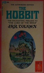
Fiction
The Hobbit
J. R. R. Tolkien · 1937 · Novel
In 1911 the young Tolkien walked through the Bernese Oberland and the Valais with friends, and he later wrote that Bilbo's crossing of the Misty Mountains came from that summer. The Haute Route ends in those Valais mountains. A Catholic author's tale of a small person on a big road.
Find it on Open Library →Pass after pass, you learn that every descent prepares the next climb.
Other treks nearby
Written by Alto from maps, hut and tourist-office information and trip reports. Check hut opening dates, snow on the passes and the state of the Europaweg before you go. Route © OpenStreetMap contributors (ODbL).