
Tasmania · Australia
Overland Track
Six days through the wild heart of Tasmania: from Cradle Mountain past Barn Bluff and the lakes of the high moors, over the Pelion Gap below Mount Ossa, through the waterfalls of the Du Cane valley to Lake St Clair.
- 6 days
- 59 km
- 1,400 m of climbing
- 5 nights in huts
Photo Karora, Public domain
The Overland Track crosses the Cradle Mountain–Lake St Clair National Park from north to south, through some of the last temperate wilderness on earth. Dolerite peaks rise out of open moorland of button grass and cushion plants; in the valleys are forests of myrtle beech, pencil pine and old King Billy pine, some of them a thousand years old.
Tasmania's weather comes straight off the Southern Ocean, and it can snow on any day of the year. In the walking season you go one way only, north to south, with a booking for the day you start; the huts are shared and first come, first served, so everyone carries a tent. In the evening, wombats graze around the huts as if you were not there.
At a glance
Fly the route
Overland Track from above
59 km on the real trail, over 3D terrain, past every chapter of the story.
Meditation planWith St Mary MacKillop: prayers for every day of the trek
Walked under the patronage of St Mary MacKillop. Australia's first saint. She founded the Sisters of St Joseph to teach poor children in the bush, travelled huge distances by coach and on horseback, and kept going through every setback. She was canonized in 2010. Feast day: 8 August.
Every day
Setting out
Each morning, before you lace your boots or at the trailhead.
Pray the offering for the long road
Lord, the road is long today, over plains and through forest, in whatever weather you send. I offer it all to you, with the people I love and the work waiting for me.
St Mary MacKillop travelled the bush to serve the poor and never gave up. Give me her steady heart, and let me notice anyone on the track who needs help. Amen.
V.St Mary MacKillop,
R.pray for us.
"Never see a need without doing something about it." Her words, for the road today.
At noon
Wherever you are on the trail, stop, take off your pack and pray together.
Pray the noon prayer of the old forest
Then shall all the trees of the woods rejoice before the face of the Lord, because he cometh. (Psalm 95:12–13)
Father, at noon we rest among trees older than anyone alive. Thank you for this wild place, for the Tasmanian Aboriginal people who have known it for thousands of years, and for all who care for it now. Help us to leave it as we found it. Amen.
In modern Bibles the verse is Psalm 96:12–13.
Pray the Angelus
V.The Angel of the Lord declared unto Mary,
R.And she conceived of the Holy Spirit.
Hail Mary, full of grace, the Lord is with thee; blessed art thou among women, and blessed is the fruit of thy womb, Jesus. Holy Mary, Mother of God, pray for us sinners, now and at the hour of our death. Amen.
V.Behold the handmaid of the Lord.
R.Be it done unto me according to thy word.
Hail Mary…
V.And the Word was made flesh,
R.And dwelt among us.
Hail Mary…
V.Pray for us, O holy Mother of God,
R.That we may be made worthy of the promises of Christ.
Let us pray.
Pour forth, we beseech thee, O Lord, thy grace into our hearts; that we, to whom the incarnation of Christ thy Son was made known by the message of an angel, may by his passion and cross be brought to the glory of his resurrection. Through the same Christ our Lord. Amen.
In camp
Each evening before you sleep: look back over the day, give thanks, ask for tomorrow.
Pray the Examen at the hut
As the wombats come out at dusk, be still. God is here.
Give thanks for the mountains, the button grass, the forest, and the people who walked with you.
Ask for light to see the day as God sees it.
Walk back over the day. When did you feel close to God? When did you feel far away?
Was there a need you passed by? Ask forgiveness.
Ask for tomorrow: strength for the track, and a heart ready to serve.
St Mary MacKillop, pray for us.
Glory be to the Father, and to the Son, and to the Holy Spirit; as it was in the beginning, is now, and ever shall be, world without end. Amen.

Day 1
Past Cradle Mountain
Ronny Creek → Waterfall Valley Hut
- 9.3 km
- ↑ 393 m
- ↓ 300 m
- 3 h 30 walking
- sleep at 1,030 m
From Ronny Creek, boardwalk leads across the button grass to the foot of the climb. The path goes steeply up to Marions Lookout, with chains on the steepest rocks, and Dove Lake opens below you, with Cradle Mountain straight ahead.
Pass Kitchen Hut, an old emergency shelter, and walk along the shoulder of Cradle Mountain on the open plateau. Then drop down into Waterfall Valley, under the great block of Barn Bluff, to the first hut.
Don't miss
- Dove Lake and Cradle Mountain from Marions Lookout.
- Barn Bluff in the evening light above the hut.
Meditation for day 1
“I have lifted up my eyes to the mountains, from whence help shall come to me.”
Psalm 120:1 (121:1)
The first day is the hardest climb. Offer it as a gift, and the rest of the road will follow.
If the weather is clear, the side trip to the summit of Cradle Mountain is a hard scramble of two or three hours return from Kitchen Hut. In wind, cloud or snow, leave it.

Day 2
The lakes of the moor
Waterfall Valley Hut → Windermere Hut
- 7.4 km
- ↑ 142 m
- ↓ 176 m
- 2 h 30 walking
- sleep at 990 m
A short day across the high moorland, with small tarns on every side and the whole of the Cradle Mountain range behind you. A side path leads to Lake Will, a quiet place for lunch.
Windermere Hut stands near the shore of Lake Windermere. On a warm afternoon, swim if you dare: the water is cold, dark with tannin from the button grass, and very clean.
Don't miss
- The tarns of the high moor.
- A cold swim in Lake Windermere.
Meditation for day 2
“Come to me, all you that labour, and are burdened, and I will refresh you.”
Matthew 11:28
A short day leaves time to look. God is in the small things too: the tarn, the moss, the wombat by the door.

Day 3
Down to the Pelion Plains
Windermere Hut → New Pelion Hut
- 15.0 km
- ↑ 317 m
- ↓ 446 m
- 4 h 30 walking
- sleep at 870 m
The longest day leaves the moors and drops into forest: rainforest of myrtle and sassafras, wet and green, with the track winding over roots and through mud. Frog Flats, by the Forth River, is the lowest point of the whole walk.
Then climb gently out onto the Pelion Plains, wide and open under Mount Oakleigh and Mount Pelion West. New Pelion Hut is the biggest on the track, with a long verandah facing Mount Oakleigh.
Don't miss
- The moss and myrtles of the forest.
- Mount Oakleigh from the verandah of New Pelion Hut.
Meditation for day 3
“Jesus himself also drawing near, went with them.”
Luke 24:15
The road goes down before it climbs again. Walk the low places with the same trust as the high ones.
The track through the forest can be very muddy after rain. Gaiters help.

Day 4
Pelion Gap and Mount Ossa
New Pelion Hut → Kia Ora Hut
- 8.3 km
- ↑ 278 m
- ↓ 277 m
- 3 h walking
- sleep at 860 m
Climb through the forest to Pelion Gap, a broad saddle between Mount Pelion East and Mount Ossa. Leave your pack here if the day is clear: a side track climbs to the summit of Mount Ossa, at 1,617 m the highest point in Tasmania.
From the gap the track drops gently into the valley of Kia Ora Creek, with the cliffs of Cathedral Mountain ahead, to Kia Ora Hut.
Don't miss
- The summit of Mount Ossa, the roof of Tasmania.
- Cathedral Mountain above Kia Ora.
Meditation for day 4
“Thy word is a lamp to my feet, and a light to my paths.”
Psalm 118:105 (119:105)
At the highest point, kneel for a moment. Everything you see is given.
The climb up Mount Ossa takes three or four hours return from Pelion Gap and involves some scrambling. Only go up in good weather.

Day 5
The waterfall valley
Kia Ora Hut → Bert Nichols Hut
- 9.6 km
- ↑ 274 m
- ↓ 249 m
- 3 h walking
- sleep at 880 m
Walk on through tall forest to Du Cane Hut, a small hut of split timber built more than a century ago by a trapper. Below it the Mersey River falls through a gorge, and side tracks lead down to D'Alton, Fergusson and Hartnett Falls: take at least one.
Then climb gently to Du Cane Gap, with the peaks of the Du Cane Range above, and down through the forest to Bert Nichols Hut at Windy Ridge.
Don't miss
- The old Du Cane Hut in its clearing.
- Hartnett Falls from the riverbed below.
Meditation for day 5
“Be still and see that I am God.”
Psalm 45:11 (46:10)
Waterfalls never stop giving. Ask for a generous heart.

Day 6
Out to Lake St Clair
Bert Nichols Hut → Narcissus Hut
- 9.6 km
- ↑ 36 m
- ↓ 175 m
- 2 h 30 walking
- finish at 740 m
The last day is an easy walk through eucalyptus forest and button grass, gently downhill, to the Narcissus River. Cross the swinging suspension bridge and come out at Narcissus Hut, on the northern shore of Lake St Clair, the deepest lake in Australia.
From the jetty, the ferry carries you down the length of the lake to Cynthia Bay. If you would rather walk, the lakeside track takes most of another day through the forest.
Don't miss
- The suspension bridge over the Narcissus River.
- The ferry ride down Lake St Clair.
Meditation for day 6
“May the Lord keep thy coming in and thy going out; from henceforth now and for ever.”
Psalm 120:8 (121:8)
The journey ends at the water's edge. Give thanks for every step, and for the people who walked them with you.
Book the ferry from Narcissus ahead, and radio from the hut to confirm your place on the day.
Before you go
No churches or chapels are mapped within 1.5 km of this trail in OpenStreetMap. Plan your Sundays in the day-by-day planner.
Bookings
From October to May you need an Overland Track booking for your start date and a parks pass. Walk north to south, and stay only at the hut sites.
Weather
It can snow on any day of the year. Carry warm and waterproof clothes, a tent and a sleeping bag good for freezing nights, whatever the forecast.
Water and waste
Drink from the tanks at the huts, and treat water from streams. Carry out all your rubbish, and use the hut toilets.
Getting there
Shuttle buses run from Launceston and Devonport to Cradle Mountain, and back to Hobart or Launceston from Lake St Clair.
The numbers
59 km, about 1,400 m of climbing, high point 1,250 m. Walking times use the Alpine signpost rule, without breaks.
The practical side
- Where you sleep
- Basic public huts are first come, first served, so you must carry a tent. Tent platforms are at hut sites.
- Permits & bookings
- In the booking season (October–May) you need an Overland Track booking and a parks pass.
- Water
- Rainwater tanks at huts and streams; treat it.
- Food & resupply
- None: carry all your food.
- Direction
- In the booking season, north to south only, from Cradle Mountain to Lake St Clair.
- Getting there & away
- Shuttle to Cradle Mountain. Leave by ferry across Lake St Clair, or walk the extra 17 km to Cynthia Bay.
- Stages
- 6 days with optional side trips to Cradle Mountain and Mount Ossa.
Rules, fees and booking systems change. Check the official source before you go: Tasmania Parks & Wildlife ↗
Books for the trail
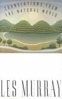
Of this place
Translations from the Natural World
Les Murray · 1992 · Poetry
Australia's great Catholic poet writes in the voices of animals and plants. Read it on the Tasmanian moors, among the wombats and pencil pines.
Find it on Open Library →
Nonfiction
Revelations of Divine Love
Julian of Norwich · c. 1395 · Spirituality
Julian, an anchoress in Norwich, wrote down the visions she received in 1373 and her long reflection on them: God's love, and the promise that 'all shall be well'. For wet Tasmanian days in the huts.
Find it on Open Library →
Fiction
Schindler's Ark
Thomas Keneally · 1982 · Novel
Keneally trained for the priesthood in Sydney before he became a novelist. His Booker-winning novel tells the true story of Oskar Schindler, a flawed Catholic businessman who saved more than a thousand Jews. An Australian classic for the evenings in the huts.
Find it on Open Library →Old forests teach patience. Some things grow only in silence.
Other treks nearby
Written by Alto from maps, Tasmania Parks and Wildlife information and trip reports. Check bookings, the ferry and track conditions with the park before you go. Route © OpenStreetMap contributors (ODbL).