
Gros Morne National Park, Newfoundland · Canada
Long Range Traverse
Five days with no trail across the plateau of the Long Range Mountains in Newfoundland: up the gorge from the end of Western Brook Pond, from pond to pond over bog and tuckamore, to the view over Ten Mile Pond and down by Gros Morne.
- 5 days
- 34 km
- 1,400 m of climbing
- 4 nights in camps
Photo Slimguy, CC BY-SA 3.0
Western Brook Pond is a freshwater fjord, carved by glaciers into the edge of the Long Range Mountains and cut off from the sea, with cliffs hundreds of metres high on either side. A tour boat runs to its far end. Most passengers ride back; a few get off with heavy packs, climb the gorge at the head of the fjord, and walk south across the plateau to Gros Morne.
There is no trail. The Long Range Traverse is a route of about 35 km that you find for yourself with map, compass and GPS, across open barrens, bogs, ponds and tuckamore, the wind-stunted spruce and fir that grows in thickets you cannot walk through. Parks Canada lets only three groups start each day, and every group needs someone who can navigate in fog.
At a glance
Fly the route
The Long Range Traverse from above
34 km on the real trail, over 3D terrain, past every chapter of the story.
Meditation planWith St Brendan the Navigator: prayers for every day of the trek
Walked under the patronage of St Brendan the Navigator. The sixth-century Irish abbot whose legendary voyage, told in the Voyage of St Brendan, took him and his monks across the western ocean in a boat of hides to a "Land Promised to the Saints". Some have wondered whether they reached Newfoundland. Many Newfoundlanders descend from Irish Catholic settlers, and Brendan, who trusted God on an unmarked sea, is a good patron for an unmarked land. Feast day: 16 May.
Every day
Setting out
Each morning, before you lace your boots or at the trailhead.
Pray the offering for the unmarked way
Lord, there is no path today, only this land of rock and water, and your hand to guide us. As Brendan set out on the open sea trusting you to bring him home, I set out across the plateau. Give us clear eyes and a true compass; keep us together in the fog, and bring us safely to the other side. Amen.
V.St Brendan,
R.pray for us.
In the old story Brendan and his monks kept the hours of prayer even at sea. Keep them on the plateau too.
At noon
Wherever you are on the trail, stop, take off your pack and pray together.
Pray the noon prayer on the barrens
O ye mountains and hills, bless the Lord: praise and exalt him above all for ever. (Daniel 3:75)
Father, at noon we rest in this wide, empty country. Thank you for the caribou and the ptarmigan, the bakeapples and the blueberries, the ponds and the wind. Bless the Mi'kmaq and the Beothuk who knew this land before us, and the outport people who still fish its coast. Amen.
Pray the Angelus
V.The Angel of the Lord declared unto Mary,
R.And she conceived of the Holy Spirit.
Hail Mary, full of grace, the Lord is with thee; blessed art thou among women, and blessed is the fruit of thy womb, Jesus. Holy Mary, Mother of God, pray for us sinners, now and at the hour of our death. Amen.
V.Behold the handmaid of the Lord.
R.Be it done unto me according to thy word.
Hail Mary…
V.And the Word was made flesh,
R.And dwelt among us.
Hail Mary…
V.Pray for us, O holy Mother of God,
R.That we may be made worthy of the promises of Christ.
Let us pray.
Pour forth, we beseech thee, O Lord, thy grace into our hearts; that we, to whom the incarnation of Christ thy Son was made known by the message of an angel, may by his passion and cross be brought to the glory of his resurrection. Through the same Christ our Lord. Amen.
In camp
Each evening before you sleep: look back over the day, give thanks, ask for tomorrow.
Pray the Examen in the tent
When the wind drops at dusk, sit by the pond and be still. God is here.
Give thanks for the day's gifts: the ponds and the barrens, the caribou, and the people who found the way with you.
Ask for light to see the day as God sees it.
Walk back over the day, pond by pond. When did you feel close to God? When did you feel lost?
Where you were stubborn or unkind, ask forgiveness.
Look at tomorrow's route on the map, and ask for the wisdom you will need.
St Brendan, pray for us.
Glory be to the Father, and to the Son, and to the Holy Spirit; as it was in the beginning, is now, and ever shall be, world without end. Amen.

Day 1
Up the gorge
Western Brook Pond (east end) → Little Island Pond
- 6.3 km
- ↑ 628 m
- ↓ 129 m
- 3 h walking
- sleep at 528 m
The boat leaves you at the dock at the far end of Western Brook Pond, under the cliffs. The route climbs the gorge at the head of the fjord beside a stream and its waterfalls: about 600 m of climbing in 4 km, over boulders, through scrub and up steep, slippery ground. It is the hardest part of the traverse, and the most beautiful.
At the top the plateau opens out, and you can look back down the whole length of the fjord towards the sea. A little further south is the campsite at Little Island Pond.
Don't miss
- Looking back down Western Brook Pond from the top of the gorge.
- The first night on the plateau.
Meditation for day 1
“I have lifted up my eyes to the mountains, from whence help shall come to me.”
Psalm 120:1 (121:1)
The hardest climb comes first, and the view from the top explains it. Look back, and give thanks.
The boat can be cancelled in high wind. Book the hikers' crossing with BonTours, and keep a spare day in hand.

Day 2
Across the barrens
Little Island Pond → Hardings Pond
- 7.6 km
- ↑ 162 m
- ↓ 217 m
- 2 h 30 walking
- sleep at 483 m
Now the real navigation begins. Head south across the plateau from pond to pond, past Marks Pond, on the faint footpaths of earlier hikers where you can find them and by compass where you can't. Ridges of bare rock make easy walking; the low ground is bog that can take a leg to the knee or deeper; and tuckamore is best avoided altogether: if you are pushing through it for long, you have probably left the route.
Camp at Hardings Pond, the largest of the campsites, and watch for caribou on the open ground at dusk.
Don't miss
- Caribou on the barrens.
- Evening by Hardings Pond.
Meditation for day 2
“How beautiful upon the mountains are the feet of him that bringeth good tidings, and that preacheth peace.”
Isaias 52:7
When the path disappears, go slowly, check often, and trust the map. Wisdom is mostly patience.

Day 3
South to Green Island Pond
Hardings Pond → Green Island Pond
- 7.3 km
- ↑ 390 m
- ↓ 269 m
- 2 h 30 walking
- sleep at 602 m
The longest day, about 7 km over the high ground south and west of Hardings Pond, with wide views across the empty plateau. Cross the streams with care after rain.
The campsites at Green Island Pond sit at the edge of a long lake. Blackflies can be fierce here in summer: bring a head net.
Don't miss
- Wide skies over the plateau.
- Evening at Green Island Pond.
Meditation for day 3
“It is better therefore that two should be together, than one: for they have the advantage of their society: if one fall he shall be supported by the other.”
Ecclesiastes 4:9–10
A long day in an empty land. Silence is not absence: God is in the wide places too.

Day 4
Ten Mile Pond
Green Island Pond → Ferry Gulch
- 5.6 km
- ↑ 245 m
- ↓ 273 m
- 2 h walking
- sleep at 555 m
Walk west to Bakeapple Pond and the edge of the plateau, and the best view of the traverse opens below you: Ten Mile Pond, another freshwater fjord, long and narrow between its cliffs, with the bulk of Gros Morne Mountain beside it.
Then make your way down to Ferry Gulch, a campsite by a small pond on the Gros Morne Mountain Trail, among other hikers for the first time in days.
Don't miss
- Ten Mile Pond from above Bakeapple Pond.
- Gros Morne in the evening light.
Meditation for day 4
“Indeed the Lord is in this place, and I knew it not.”
Genesis 28:16
From the edge you see how far you have come. Every journey of faith has moments like this: keep them.

Day 5
Down by Gros Morne
Ferry Gulch → Gros Morne Mountain Trailhead
- 7.5 km
- ↑ 16 m
- ↓ 575 m
- 2 h 30 walking
- finish at 14 m
If the weather is clear, leave your pack at Ferry Gulch and climb Gros Morne Mountain, at 806 m the second-highest summit in Newfoundland: about 5.6 km there and back, and two or three hours. From the top you look down on Ten Mile Pond and back over the plateau you crossed.
Then walk out on the Gros Morne Mountain Trail, about 7.7 km, to the trailhead on Route 430 near Rocky Harbour, and let the park know you are out.
Don't miss
- Ten Mile Pond from the summit of Gros Morne.
- The sea again at the end.
Meditation for day 5
“May the Lord keep thy coming in and thy going out; from henceforth now and for ever.”
Psalm 120:8 (121:8)
You come down to the road and the cars. Carry the silence of the plateau a little longer.
Before you go
No churches or chapels are mapped within 1.5 km of this trail in OpenStreetMap. Plan your Sundays in the day-by-day planner.
Navigation
There is no trail and no waymarking. At least one person in your group must be able to navigate with map and compass in fog; carry a GPS with the park's track and a satellite messenger, which the park can lend if you have none.
Bookings
Three groups a day, of up to four people, from late June to the end of September, reserved with the Parks Canada Reservation Service. You must come to a briefing at the Gros Morne visitor centre in the afternoon of the day before you start, or you lose your place.
The boat
BonTours runs the boat on Western Brook Pond; book the hikers' crossing. The dock is about 3 km on foot from the parking area on Route 430.
Weather
Fog, low cloud, wind and rain can come at any time, and the plateau has no shelter. Be ready to wait out bad weather in your tent, and carry spare food.
The numbers
34 km, about 1,400 m of climbing, high point 682 m. Walking times use the Alpine signpost rule, without breaks.
The practical side
- Where you sleep
- Small backcountry campsites, most with wooden tent pads and a food cache: Little Island Pond, Marks Pond, Hardings Pond, Green Island Pond and Ferry Gulch. You camp only where your permit says.
- Permits & bookings
- A Long Range Traverse backcountry permit, reserved with the Parks Canada Reservation Service (three groups a day, up to four people each) and collected at a briefing the afternoon before you start; a park pass; and a ticket for the boat.
- Water
- Ponds and streams everywhere. Treat everything.
- Food & resupply
- None; carry all your food, with a day or two spare for bad weather.
- Direction
- North to south: by boat to the end of Western Brook Pond, then across the plateau to Gros Morne.
- Getting there & away
- Western Brook Pond parking area on Route 430, north of Rocky Harbour, and a 3 km walk to the boat dock. The route ends at the Gros Morne Mountain trailhead on Route 430, south of Rocky Harbour.
- Stages
- 3–5 days, about 35 km off trail that often feels longer. The gorge on the first day climbs about 600 m in 4 km. Several streams can be knee-deep after rain, and fog can stop you for a day.
Rules, fees and booking systems change. Check the official source before you go: Gros Morne National Park: Long Range Traverse ↗
Books for the trail
Of this place
The Voyage of St Brendan
Anonymous · c. 900 · Classic
The medieval tale of the Irish abbot who sailed the western ocean with his monks for seven years, keeping the feasts of the Church on islands, on rocks and once on the back of a whale, until they reached the Land Promised to the Saints. Read it on an island many of whose people came from Ireland.
Find it on Open Library →
Nonfiction
The Confession of St Patrick
St Patrick · c. 450 · Memoir
Patrick's own short account of his life: carried off from Britain to Ireland as a slave, escaping, and going back as a bishop to the people who had enslaved him. Ireland's apostle in his own plain words, for a land settled by so many of his people.
Find it on Open Library →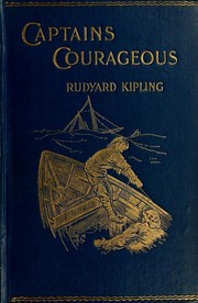
Fiction
Captains Courageous
Rudyard Kipling · 1897 · Novel
A spoiled rich boy falls off a liner and is pulled out of the sea on the Grand Banks off Newfoundland by a fishing schooner, where he has to work for his keep. Kipling's story of hard work, friendship and growing up among fishermen.
Find it on Open Library →No trail and no signs: only the map, the compass and the ground under your feet. Faith often works like that.
Other treks nearby
Written by Alto from maps, Parks Canada information and trip reports. Check bookings, the route description and conditions with Gros Morne National Park before you go. Route © OpenStreetMap contributors (ODbL).